Geopark Fieldwork Of Hungarian Cartography Students
Published on 4 September 2022, 14:42 by Edina Hajdú on News
How can university and geopark staff promote geoheritage through different earth science fields? A good example is the fieldwork of the cartographer and GIS students of the ELTE Eötvös Loránd University (Budapest, Hungary), who also got to know the geoheritage of the Bakony–Balaton UNESCO Global Geopark alongside their mapping task.
The accommodation and central settlement of the fieldwork was in Felsőörs, in the eastern part of the geopark. Six students participated who choose cartography and GIS as their main earth scientific interest. Their task was the reambulation of 30-40 years old civilian topographic map sheets that required a lot of fieldwork: from day to day they visited the surroundings of Felsőörs and made field notes in their GPS devices and on the printed map sheets. The final product was to compile a relatively correct topographic map of their sample area that shows the current state of the natural and manmade environment.
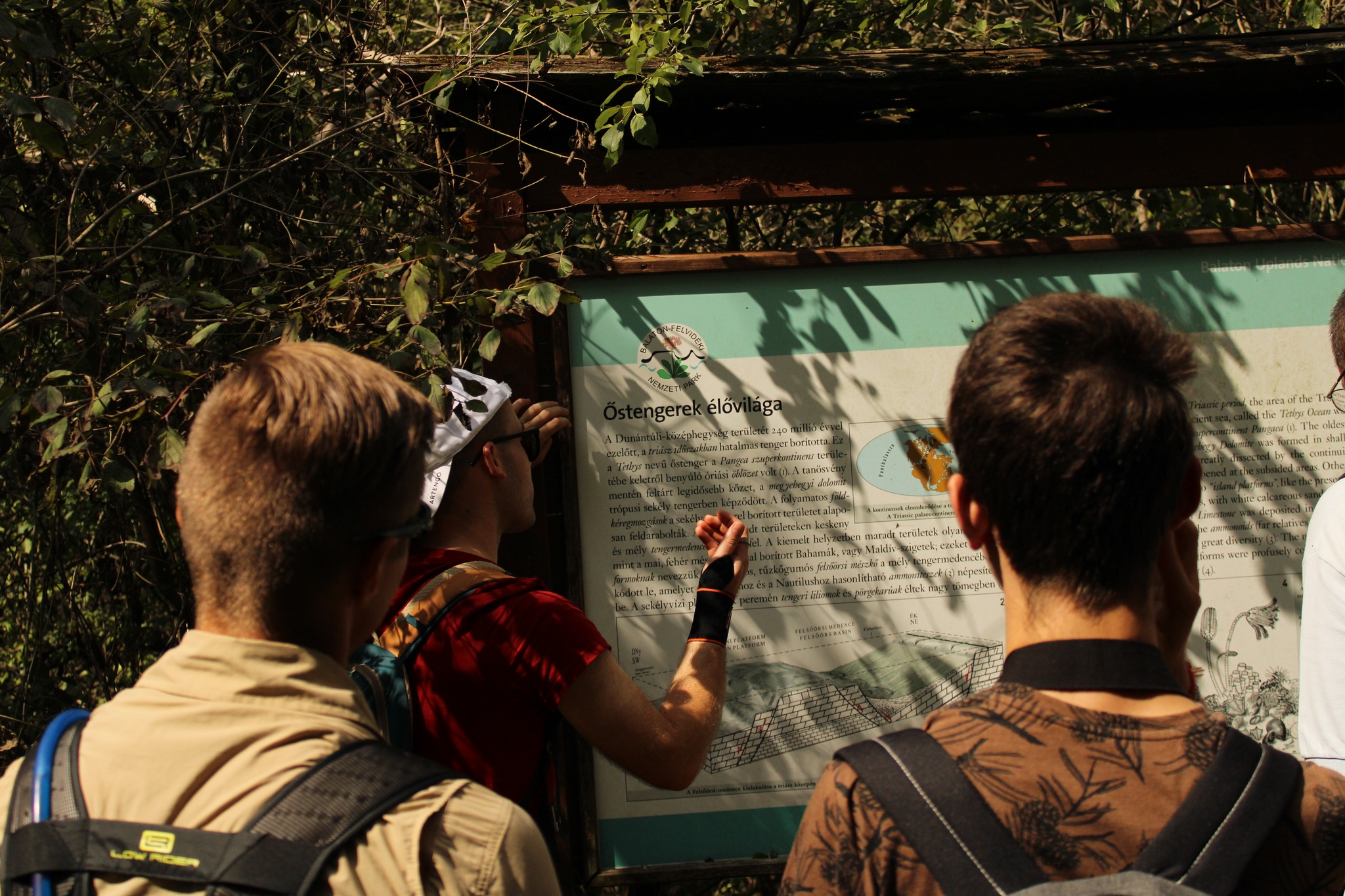
Of course, there were some days with less strict programme when we visited some important geosites of the Bakony–Balaton Geopark. Edina Hajdú (the Youth Forum delegate of Hungary) and Márton Pál (the secretary of the Hungarian ProGEO organisation) escorted the students on the field giving information on the earth scientific and cultural past of the area, the exciting characteristics of each geosite or the connection to the local people's identitiy. We are sharing some images and information of the visited geosites and the success of the quasi-geotours to encourage connecting scientific branches to get involved in the sustainable promotion of earth scientific heritage!
On the side of the Szent-Kereszt Hill a vertical rock rib extends over the valley. The beds, which are set on their edge due to tectonic movements, belong to the Middle Triassic Iszkahegy Limestone. The dark grey rock was formed at the low-energy, poorly-ventilated bottom of a lagoon which was restricted from the open sea.


The oldest and most well-known and world-famous geological key section in the Balaton Uplands can be found in the northern outskirts of Felsőörs, on the side of the Forrás Hill. The key section, in which a geological nature trail was developed recently, exposes the 242–238-million-year-old Middle Triassic succession ranging from the Middle Anisian up to the Middle Ladinian.

The Tihany Peninsula — located on the northern side of the Lake Balaton — is one of the most popular tourist destinations in Hungary. Due to its unique geological–geomorphologic natural values it was declared protected in 1952 as the first landscape protection area in Hungary. Since 2003 it has been the holder of the European Diploma. Its almost thousand-year-old Benedictine abbey attracts hundreds of thousands of tourists. Most of them walk all over the geological values which can be found along the Lajos Lóczy Nature Trail. The visitor centre of the Geopark, i.e. the ‘Lavender House’ was opened in 2011; at the same time it is the Eastren Gate of the Bakony–Balaton Geopark.


The Way Of Water - Youth Initiatives For Island Geoparks
Published on 7 June 2023, 18:23 by Immanuel Deo Silalahi on News
6th International Summer University Of The UNESCO Chair Of "Geoparks, Sustainable Regional Development And Healthy Lifestyles"
Published on 20 July 2022, 21:15 by Immanuel Deo Silalahi on Information
Geopark Game- The Lost Collection The Hondsrug UNESCO Global Geopark
Published on 31 August 2022, 01:18 by Sophie Van Rossem on News
Recent Articles